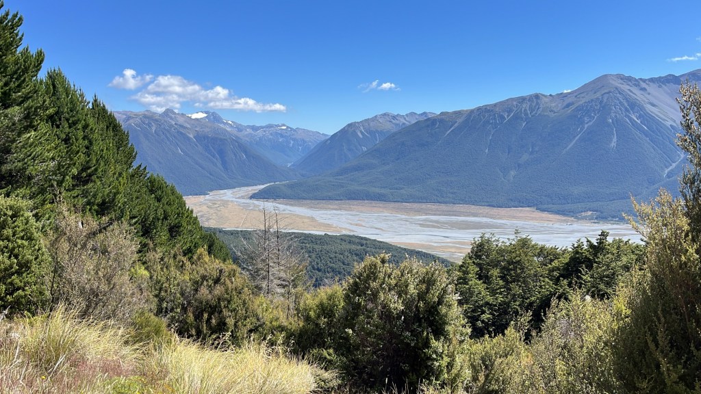
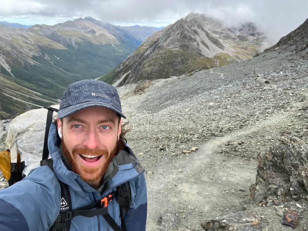
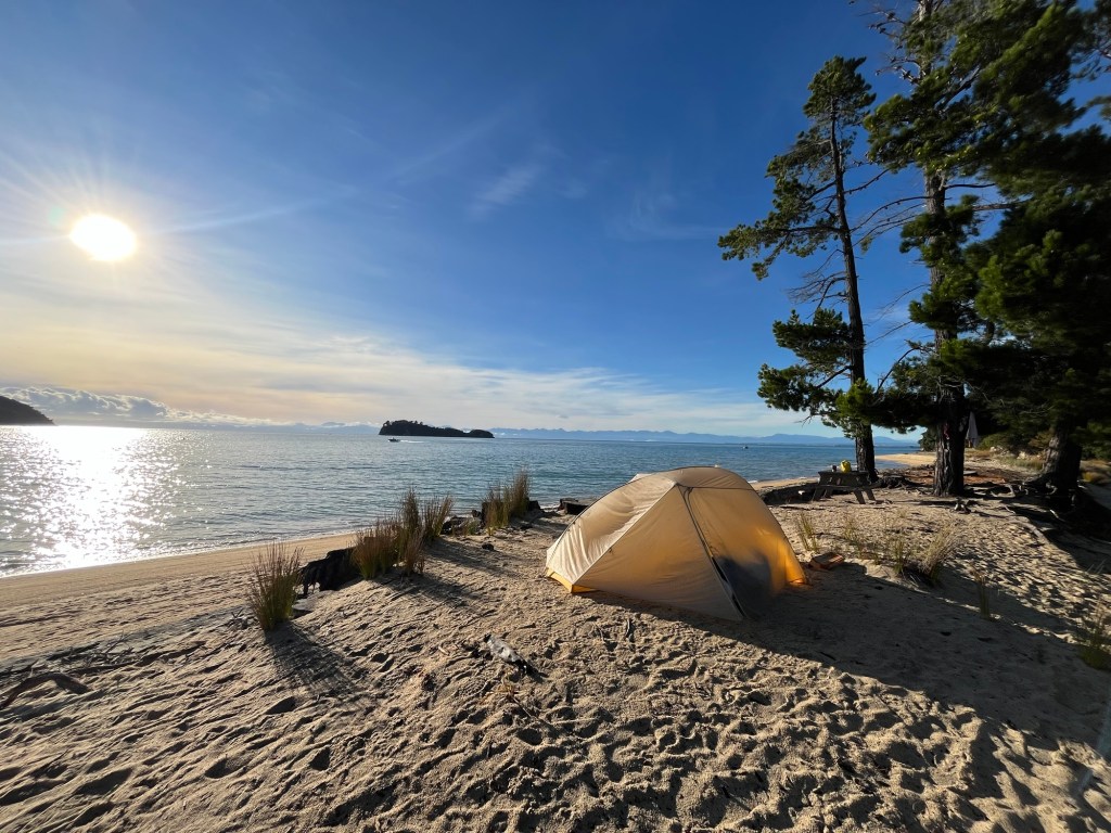
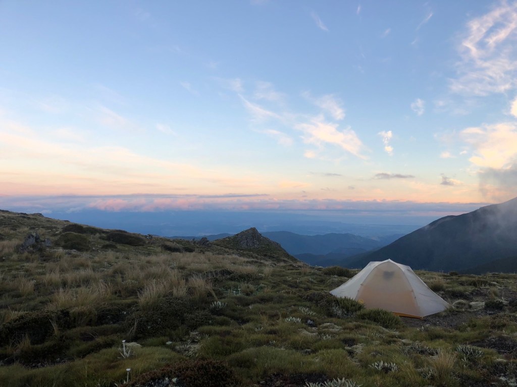
Climbing out of the Waimakariri River from Arthur’s Pass
From Arthur’s Pass was a three day section along the Harper River track to Lake Coleridge. I started the section alone, but quickly reunited with Clare, Rachel, and Andy, three Brits who I’d met in the Richmonds and Nelson Lakes. We passed the night at Hamilton hut. I slept in my tent outside of the hut, but moved into the cozy hut to shelter from sandflies and enjoy the old hut copies of National Geographic the next morning.
Back home, my favorite way to pass a morning is with a book and cup of coffee on the couch. There’s no better time to be absorbed written word than when my head is clear and caffeine sharpens my focus. On the trail, most hikers like to get moving around 7-8 am, leaving the huts empty until the afternoon. I loved to take a short day and spend a few extra hours in an empty hut reading and sipping instant coffee, just like home.
Hamilton Hut on the Harper River track
Just over a month in from the my start, I was becoming aware of a looming deadline to finish the trail. I had loose plans to meet my ole pal, Justin Newman, in Nepal come early March. Those plans were crystallizing as we set a date to meet in Kathmandu on my birthday, March 9th. For the first time since I’d started walking from Ship Cove, I felt a weak urgency to reach Southland in the next month. I’d never been hard set on making it to the official end of the trail in Bluff, but there were places and tracks I wanted to get to along the way.
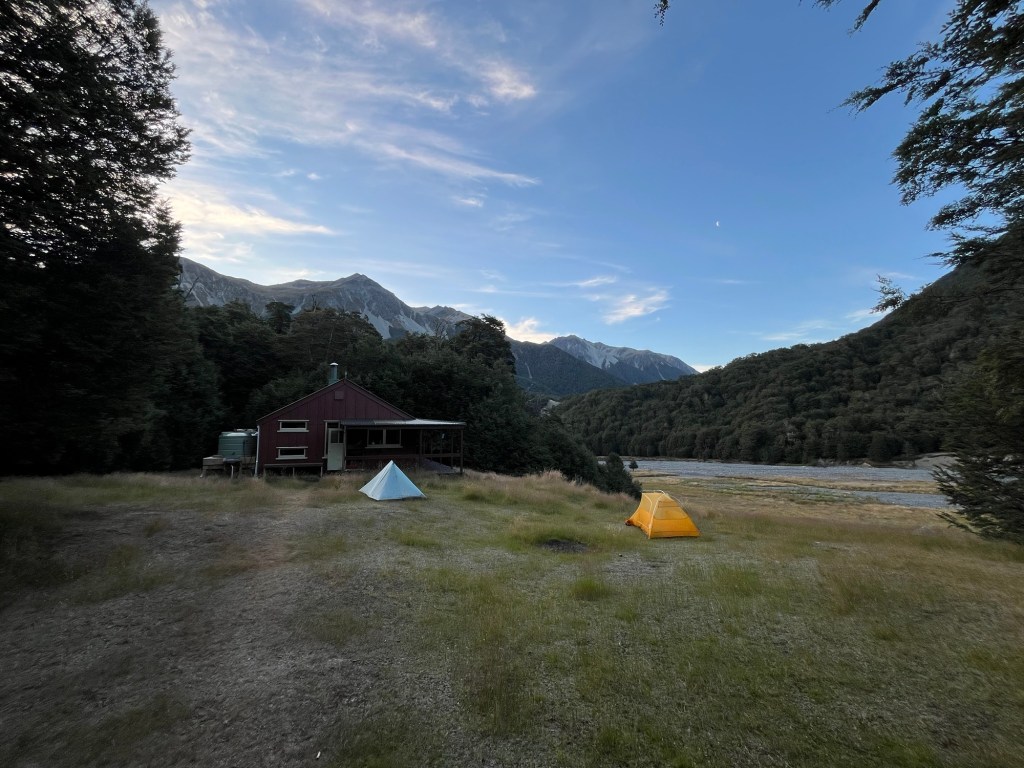
I made it out of the Harper River section after a night on Lake Coleridge. At the end of this section is Lake Coleridge Lodge, a historic lodge on the south side of the lake now run by a sweet couple from Christchurch with help from their daughter. About 15 hikers converged on the lodge for the night. We were all greeted with a can of Coke and a homemade cookie. I feasted on hot chips (French fries), waffles, and ice cream, while planning the next section with Clare and Rachel.
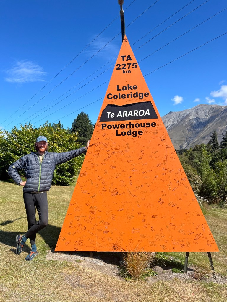
Cheesing with the biggest trail marker in New Zealand at the Powerhouse Lodge.
We decided to hitch and shuttle around the next section between the Rakaia and Rangitata rivers in order to reach the Southland and Fjordland sooner, and avoid potential shuttle logistics to get around the Rangitata. These rivers typically need to be shuttled around, requiring 100s of kilometers of driving. A dry summer in Canterbury had left the Rangitata with record low flows and many hikers were wading across.
After a shopping for the next section in the small farming town of Methven, I landed two easy hitches to Geraldine, another small Canterbury town where we could get a shuttle back into the Southern Alps to start the next section, the Two Thumbs track from Mesopotamia Station to Lake Tekapo.
I’ve mentioned hitch hiking many times, as it was my main method of transport while on the South Island. Hitching in NZ was exceptionally easy and almost always enjoyable. My favorite rides were with locals. With tramping being a common pastime amongst Kiwis, most are happy to pick up a fellow tramper looking for a lift down the road. It’s an exhilarating moment when a car pulls over and the excitement of success circulates through you. I had some wonderful conversations. Some standouts- John from Nelson, an 82 year old inventor who’s lived in Zambia, South Africa, the US, the UK, and now NZ; he invented modern inkjet technology used in printers. Scott and Gabrielle from Richmond, humanitarian workers who spent 8 years in the Dolpo of northwest Nepal; they shared stories that evoked imagery from Peter Mathieson’s book about travel in that region, The Snow Leopard. The British professor from Methven, the punk rocker from Gore, the ex-con from Invercargill, the tow truck driver from Te Anau. They all welcomed me into their vehicles and helped me get into town or back to the trail. I sure stacked up a lot of karmic debt along the way. If you’re reading this, do me a favor and pick up a hitch hiker next time you can. Who knows, it might be me.
From St. Arnaud the trail heads south into Nelson Lakes National Park. Going into the Southern Alps, the landscape became more impressive. The mountains south and west of St. Arnaud were mostly covered in ice as recently as 12,000 years ago, with only the smallest remnants of an extensive ice field remaining. Though the Southern Alps are not exceptionally high in elevation, the combination of recent glaciation and extensive alpine environment above tree line make for dramatic ridge lines. The post-glacial, alpine landscapes in the sections to come would be scenic and geologic highlights for me.
My first real taste of this was at Lake Angelus. A small side trek off of the proper TA route, the lake is a glacial tarn, or a body of water that fills the depression formed near the top of a glaciated valley, often nested just below a cirque and above a sheer drop into a U shaped valley. My departure from St. Arnaud coincided with a group of three hikers I had met at the end of my walk on the Abel Tasman track. We climbed to the ridge above Angelus hut together and traversed through the ridge separating Lakes Rotoiti and Rotoroa. It was a stunning traverse. I’m writing this 6.5 weeks from the day, but the memory of walking along that ridge above so many hanging valleys is clear enough to make me feel giddy all over again.
Looking south on the ridgline north of Lake Angelus
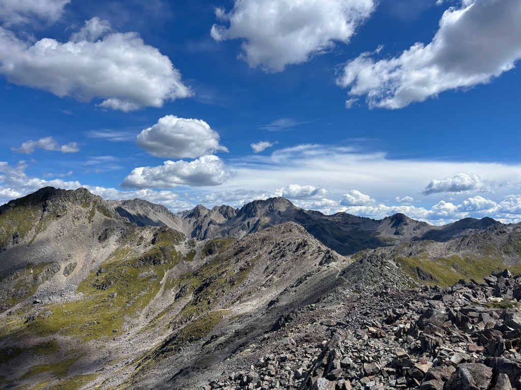
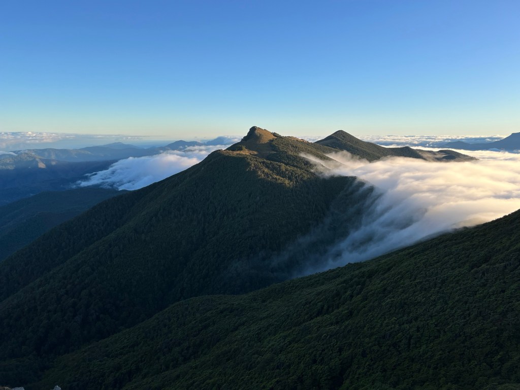
Ridge walking on the TA quickly became my favorite terrain. The steep ascents generate a state similar to a runners high. When my respiration is under control I enter a flow state that feels like I could climb at my greatest output for a long time. In this state, I reach a saddle, or high pass, and am completely captivated by the place. While walking along a ridge surrounded by bare rock that has been so clearly sculpted by ice there is no competition for my attention. I am strong, alive, and in paradise. It can be sunny, rainy, windy, does not matter, it’s pure bliss. From Nelson Lakes to my end point in Te Anau, I was entering this state every other day or so, whenever the trail crossed a pass or followed a ridge. Engaging in such intense physical and positive psychological activity at high frequency for 8 weeks straight generated the most consistent, highest feeling of well being I’ve experienced yet.
Alpine elation on Waiau Pass
At Lake Angelus, I was surprised to be joined by my Richmond Ranges hiking pal, Chris. We made dinner in the well appointed hut where we met a German man with his wife and infant. This guy had walked the TA in 2014(?), long before the Trail App, Farout (apps used as gps with notes about trail conditions), and such things as hiker bubbles. Though the TA is a relatively young thru hike compared to the trails in the states, it was fun to engage in some hiker heritage. Back in my day on the TA…
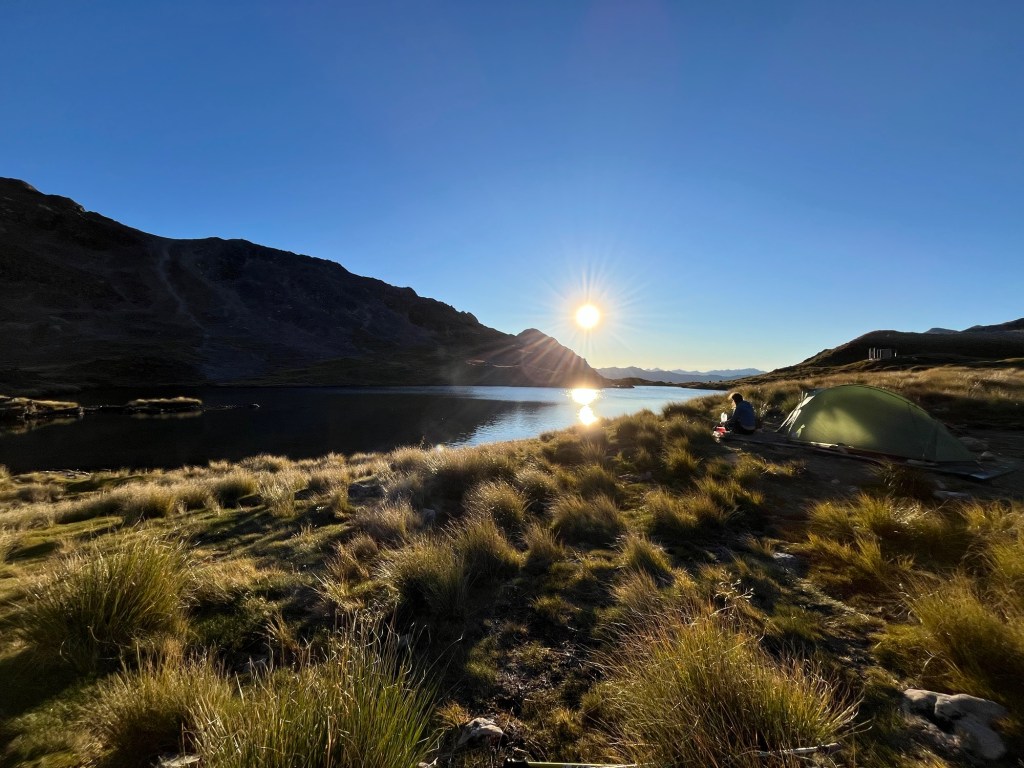
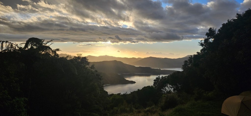
Morning light over camp at Lake Angelus
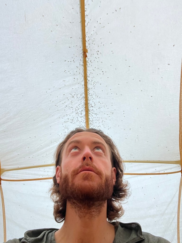
Chris and I set off for the Sabine River the next morning. I’d camp alone on the river that night and experience some of the worst sandflies I found on trail.
Sandflies on the right side of the netting. Is that rain on a tin roof? No, it’s just sandflies on your rain fly…
Already under the spell of “see ya down the trail”, I didn’t say goodbye to Chris on the Sabine River, confident I’d catch her down the way or in the next town. Alas, that was the last time I’d walk with her. Blake, too, I’d left in St. Arnaud without saying a proper goodbye, and we wouldn’t overlap on trail again. It’s ironic that we would walk the same path for weeks with only 20 or 40 kilometers between us and miss each other completely.
The following day took me to Blue Lake Hut, another big hut on the west shore of Blue Lake, which boasts the clearest fresh water in the world with 80m visibility. Water at this clarity needs no filtration and makes for icy swimming, great preparation for the steep Waiau Pass section the next day.
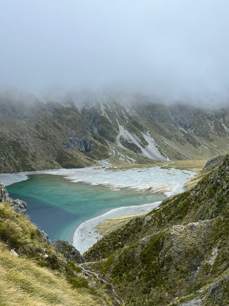
Looking down on Lake Constance on the approach to Waiau Pass
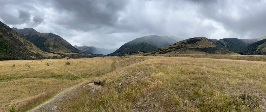
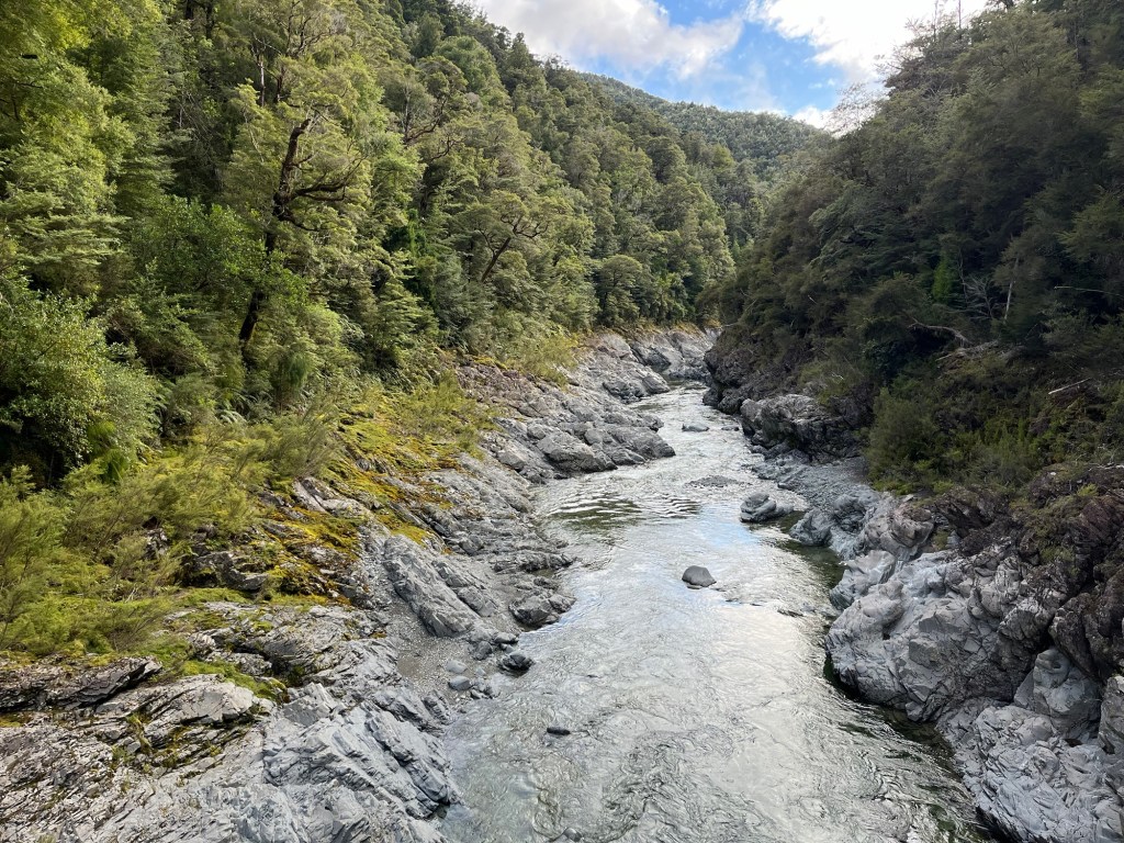
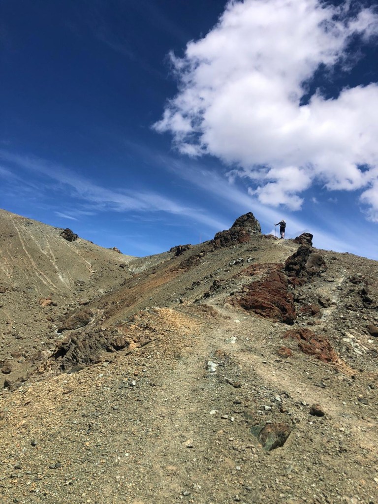
Southbound over Waiau Pass, the trail enters the Canterbury District, and the landscape changes drastically from Marlborough. After walking and crawling along many rough river tracks through narrow, beech forested valleys, scrambling up and down steep rooty and rocky sections paralleling rivers, the Canterbury was a welcome change for me. Rivers there flow through grass carpeted terraces, relicts of the sediment laden braided rivers present during the last retreat of mountain glaciers, all fringed by beech forest. Grassy terraces make for cruisey walking! The open valleys of Canterbury reminded me of home in southwest Montana.
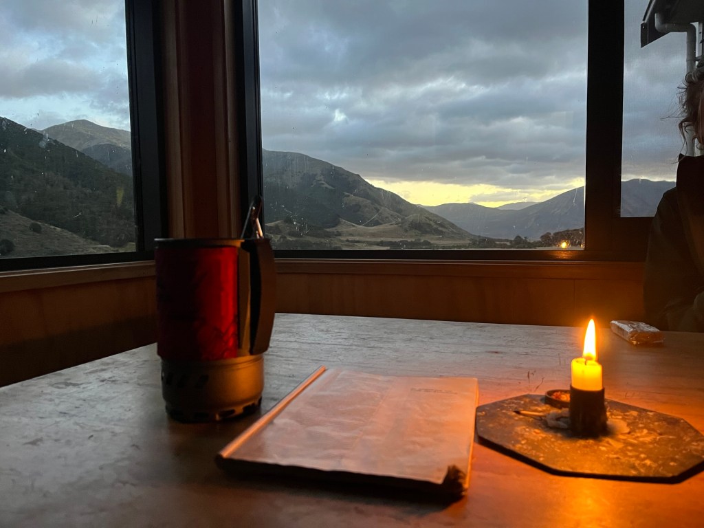
Waiau Hut- camp for the night after Waiau PassBroad terraces filling the upper Waiau River valleyEnjoying some National Geographic and tea in Anne Hut on the St. James Walkway.
I limped out of the Waiau Pass section along the St. James walkway to Boyle Village. From Boyle, I caught a perfectly timed hitch with some other hikers. I’d had a rough day with an episode of IT-band syndrome locking up my left knee. With mellow terrain for the day, it was an ideal stretch for a bum knee, and it was the last day of six for that section. I had two full days of rest in Hanmer Springs, a small town in northern Canterbury popular for its hot springs. It was a lovely place to rest my knee. I even went for a deep tissue massage here and quickly found out that a lot of my knee pain was related to tightness in my glutes. The glutes are where a lot of power comes from for climbing and descending, both of which I’d been doing a lot of. Insufficient recovery and stretching had led mine to hold a lot of tension, causing tightness in my IT band. I eventually relieved this pain through stretching.
From Hanmer, it was south bound along the Hope and Hirunui Rivers, over Harper Pass to the Taranakua River and into the West Coast region. This section was a solitary one for me, hiking alone for three days, camping with the sandflies and appreciating the quiet.
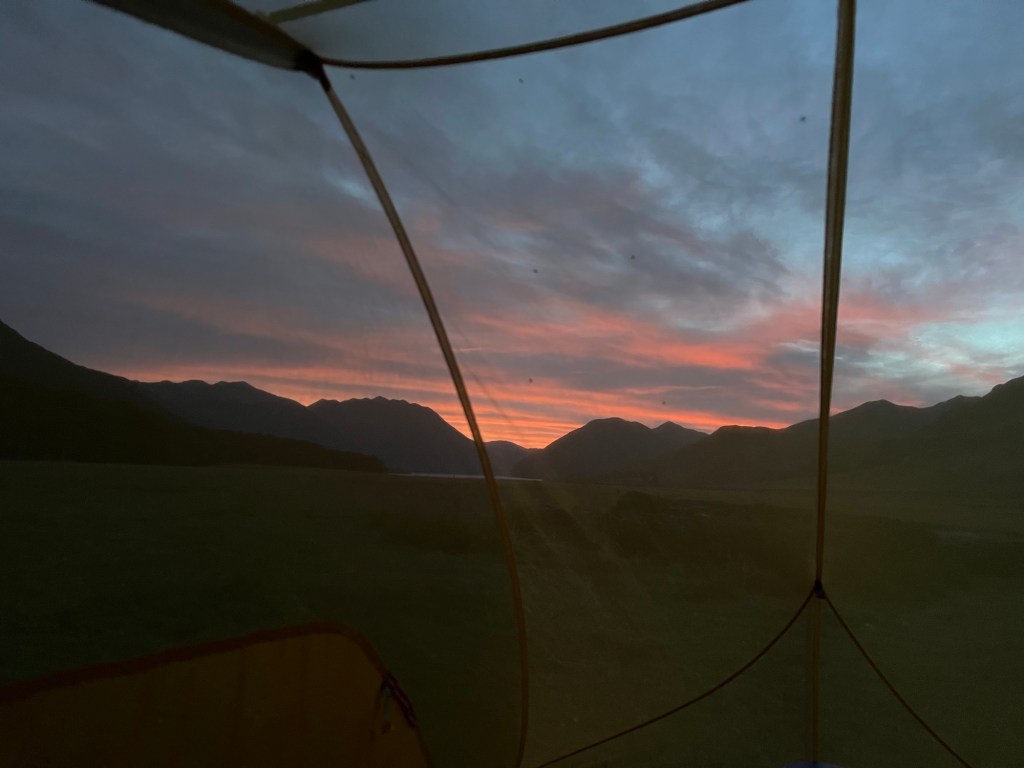
Sunset over Lake Sumner on the safe side of the netting.
The end of this section marked thirty days since starting the trail at Ship Cove. I’d had feet and knee problems all the way along for this first month. If anyone reading this is looking for a quick way to find a challenge, I highly recommend walking 10 to 20 miles a day for a month over uneven terrain. Your feet will revolt with blisters and soreness, your knees will protest in pain from tendon strain, you’ll get sunburned; you’ll be hot, cold, and wet; depending on where you go you’ll probably be driven to the edge of madness by bugs. In spite of it all, you just might be the happiest you’ve ever been.
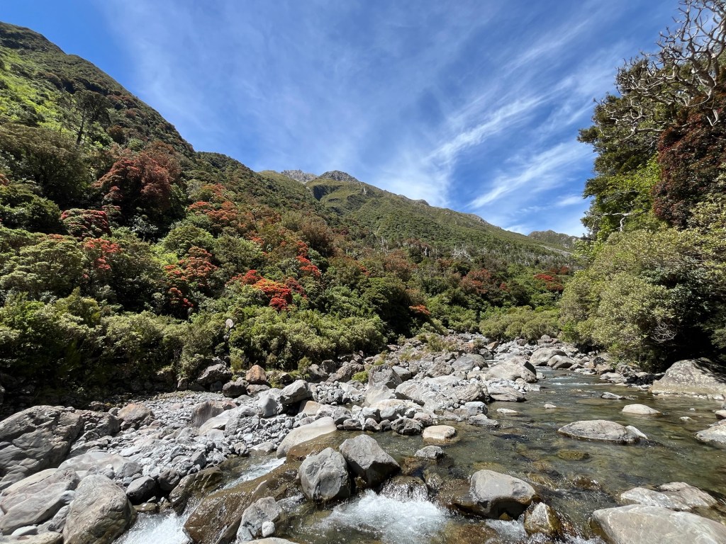
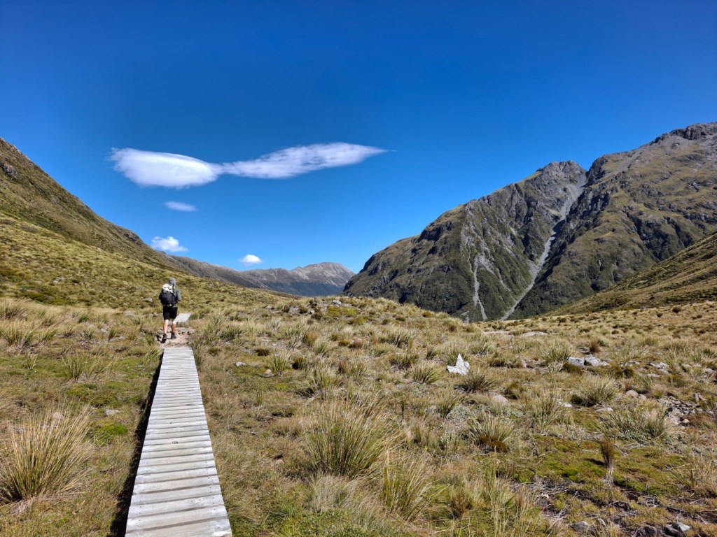
I jumped off the trail and hitched into Arthur’s Pass for a night in town. I rendezvoused with Clare, a lovely British hiker I’d coincided with on the last few sections. On a brilliant recommendation, we stowed our overnight gear and food at the hut we were staying at in AP and hitched back to “slack pack” the popular Goat Pass section. This section in Arthur’s Pass National Park follows the Deception River below a canopy of Southern Red Rata with crying flocks of soaring alpine parrots, Kea, to Goat Pass. South from the pass, boardwalks gently traverse the alpine tussocks then the trail drops into the Mingha River and back into Canterbury.
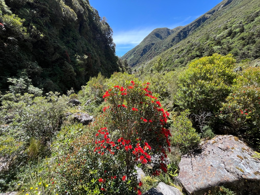
Bright Southern Red Rata trees contrast against the rest of the green canopy over the Deception River. The trail simply runs up the riverbed here.
Doing this section with a light pack was exceptional, as the walking involved a lot of boulder hopping and scrambling in the river bed. Going from a 14kg pack with all of my gear and multiple days of food to a 2 or 3kg pack with only the essentials for a day was liberating. We cruised across the pass, enjoying many cold pools in the Deception River en route.
Cruisey board-walking on the way down from Goat Pass to Mingha RiverStunning Southern Red Rata on the Deception River.
I promised update emails from my walk in New Zealand. Now that I’ve finished, I’m making some time to put some memories “on paper”.
I’ve been walking for the last 60 days on a trail called the Te Araroa, Māori for the Long Pathway. It wiggles from Cape Reinga at the northernmost point of New Zealand’s North Island to Bluff, the (almost) most southerly point of the South Island, just over 3,000 km long.
When deliberating what to do with myself before reaching the Himalaya for trekking season, I decided to do a long walk, preferably in the summer season. That narrowed my options, and the TA jumped to the top of the list. I had two months to burn before turning for Nepal, so I decided to walk the trail through the South Island, skipping the road walking of the North Island section of trail.
I’ve been set on walking a long trail, or thru hike, for about 14 years. I was introduced to the idea of spending an extended period with a pack on the back by the Martin Sheen film, The Way, which is about a man who looses his son late in life. The film follows his walk along Spain’s Camino de Santiago where he spreads his son’s ashes along the way. The US has the top three thru hikes in the world, the Triple Crown of the Pacific Crest, Continental Divide and Appalachian Trails, the PCT, CDT and AT respectively. These are all famous for their distance, continuity, and the mountain ranges they follow. So, why haven’t I hiked one yet?? Well, they take time. To finish the PCT in three months, one would need to walk 29.5 miles/day without a single day off. The ultra runner, Karel Sabbe, holds the record for the PCT, 46.5 days, an average of 55.75 miles/day (mind blown emoji here!!). Normal humans can’t recover rapidly enough to tolerate such distances and need 4-5 months to walk the trail. Similar times are necessary for the AT and CDT. Time of year for these hikes is April-November. As a field geologist, these are tricky times to skip work. So, in the southern hemisphere with two months to walk, the TA through the South Island was a perfect fit!
I left California and jumped into the future, landing in Auckland, the largest city in New Zealand with a population of 1.7 million, on December 30th. I bussed down to Wellington, NZ’s windy capital, and rang in the New Year on the Harbor with some new Dutch friends.
Filming location from Lord of the Rings- Fellowship of the Ring. This spot in the Mount Victoria Park in central Wellington was used for in the 1st LOTR film where the three Hobbits first encountered the Nazgûl.
Not interested in spending much time in the city, I rode a ferry across the Cook Strait to the peaceful town of Picton, my gateway to the Marlborough Sound and the beginning of my long walk. I spent a day shopping for the last of my supplies and waiting around for the post office to open up so I could ship food ahead to points down the trail. Then, I was off on a smaller ferry for the start of the trail on the South Island, Ship Cove and the Queen Charlotte Track.
Rearing to go at Ship cove. First km, 1,033 to go!
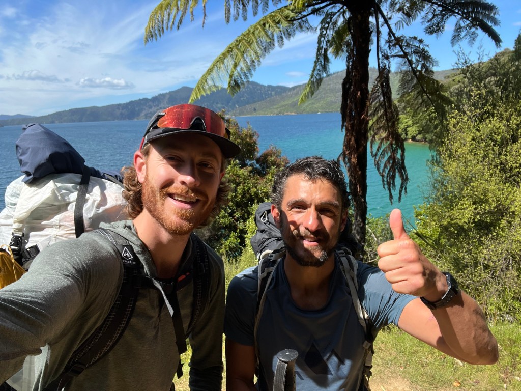
In the months leading up to the trail, I’d had my doubts about traveling alone for two months. I’ve done it before, but after a year of working mostly solo in the field, I was craving some company. A good friend reminded me that solo travel is the best way to meet new people. You have the space to open up to new people and are eager for new encounters. On the ferry to Ship Cove, I met a wonderful Spaniard, Javi, a doctor from Bilbao. We quickly took a liking to each other, sharing in some great conversations, me stumbling to keep up with his quick Castilian Spanish, and joined forces and walked the Queen Charlotte section together to Havelock. This was my introduction to the strong community that forms amongst people walking the trail together.
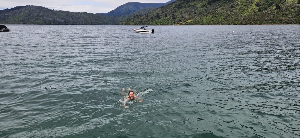
Trail rule: NEVER pass up an opportunity for a swimAll smiles on the Queen Charlotte Track. Note the massive fern trees.
On the second night of the Queen Charlotte Track, we were camped up on the ridge between Kenepuru Sound and the Bay of Many Coves. Here we met the Williams, a family of 6 hiking the entire TA with kiddos ranging from age 6 to 13(?). I was stunned and impressed by this family. Dairy farmers, they’ve uprooted for 7 months, schooling the kids on trail and walking ~20 km/day with huge packs. This wouldn’t be the first time I’d cross paths with them, nor the only family with young kids that I’d encounter along the way. These guys impressed on me the importance of disregarding social convention and choosing to live the way you are called to.
Bay of Many Coves campsite on the Queen Charlotte Track
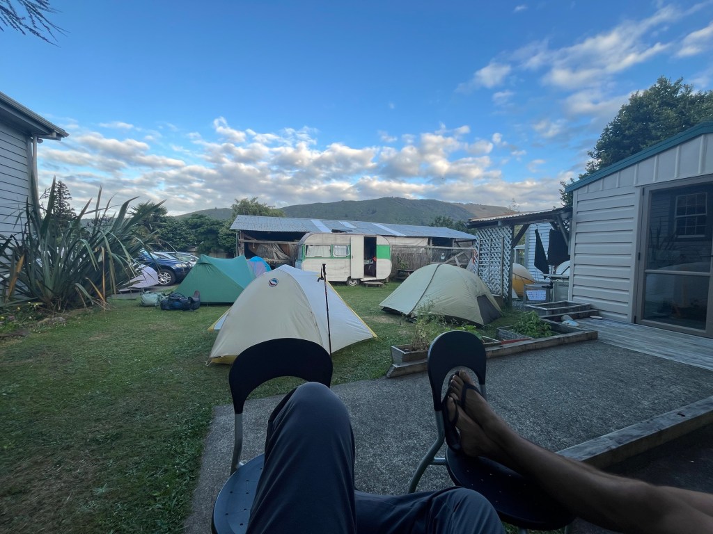
Javi, being very fit and having walked other long hikes in Europe and North Africa, set a high pace out of the gate. With tendinitis in my knees and nasty blisters, I limped into Havelock, the first resupply town on the South Island. I needed a day off and took my first “zero” day in this village famous for its green lipped mussels. The go-to accommodation when in town for resupply is tenting in a holiday park. This experience is variable, from camping in a hostel’s backyard to a proper developed campground; essential amenities include showers, laundry, a kitchen, wifi and walking access to food; bonuses include a TV lounge with a decent dvd selection.
Your average $30 NZD/night accommodationTaking advantage of the hostel kitchen for some hamburguesas Americanas and hot chips.
I said goodbye to Javi, who plowed on to the next section setting record times, and made my way to Nelson for a side trip to Abel Tasman National Park. This would be my introduction to the Kiwi way to manage a National Park, and, The Great Walks, a set of well built and tightly managed scenic tramps (hikes). Throughout my walk, I’ve been increasingly impressed by the management style of public lands by NZ’s Department of Conservation for reasons I’ll expand on as I go.
People often say that New Zealand is partially frozen in time with many parallels to the US before the introduction of the smart phone. The country has no interstates, most communities are rural and agricultural, with independent farms yet to be amalgamated by corporate agriculture. Even childhood seems to have avoided the hard blows of technology. I have yet to see the iPad parenting so common in public in the US. I see kids roaming around unsupervised, ripping bikes through campgrounds reminiscent of how my parents let me roam on our summer camping trips to Northern California.
Crossing the Awaroa Inlet on the Abel Tasman trackBeach camping a la Abel Tasman at Apple Tree Bay.
Then there’s the country’s national pastime, tramping (hiking). With most of the National Parks and conservation areas being accessible only by foot, overnight family tramping trips are common, bolstered by the hut system that is maintained by DoC. Huts have bunk beds with a mattress, rain capture water tanks- some of which are plumbed to sinks inside, countertops for cooking, dining tables, wood burning stoves, and drop toilets. The fanciest of huts on the Great Walks require reservations far in advance and have extra amenities, even gas-burners that DoC helicopters in fuel for. Most of the popular tracks here have a hut every 4-8 hours of walking. These provide a space to sleep, cook and rest out of the elements and away from the maddening sand flies. I reckon the hut system is a big part of tramping’s popularity throughout the NZ. The hut provides respite and a sense of security. No matter how bad it is out there, you can always make it to a hut and throw out your bed roll on the floor.
I enjoyed the Abel Tasman immensely. I swam in the warm waters of Tasman Bay every, met heaps of lovely Kiwi and Aussie trampers, and used the mild track as a recovery walk for my blistered feet and sore knees, they’d need it for the next section.
After a night in Nelson, Tasman Bay’s booming metropolis, I landed a quick hitch to Pelorus Bridge, the beginning of the Richmond Ranges section, or “the Richmonds”. This is a much discussed section of the trail. Leading up to it, hikers are gauging the amount of food they’ll carry for it, the number of days needed to make it through to the next resupply in St. Arnaud. Afterwards, the section lives on in countless conversations about the state of the track, the number of puads (Pointless Up And Downs), the nearo (nearly-zero) days between grueling climbs, the damn wasps!!, the DAMN sandflies!!!! I landed at Pelorus Bridge campsite at 8am and made my way down the gravel road to the trailhead.
Pelorus River. You might recognize this spot from the barrel riding scene in Peter Jackson’s, The Hobbit.
I took 8 days to make it through the Richmonds as a part of a large bubble of hikers who had built up on trail after concentrating in Wellington for New Year’s. This was a blessing, as I met most of the hikers with whom I’d spend the next 50 days walking amongst.
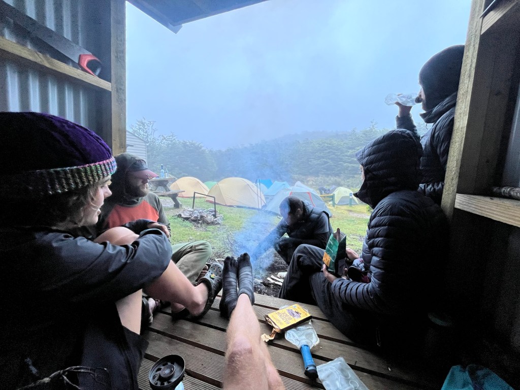
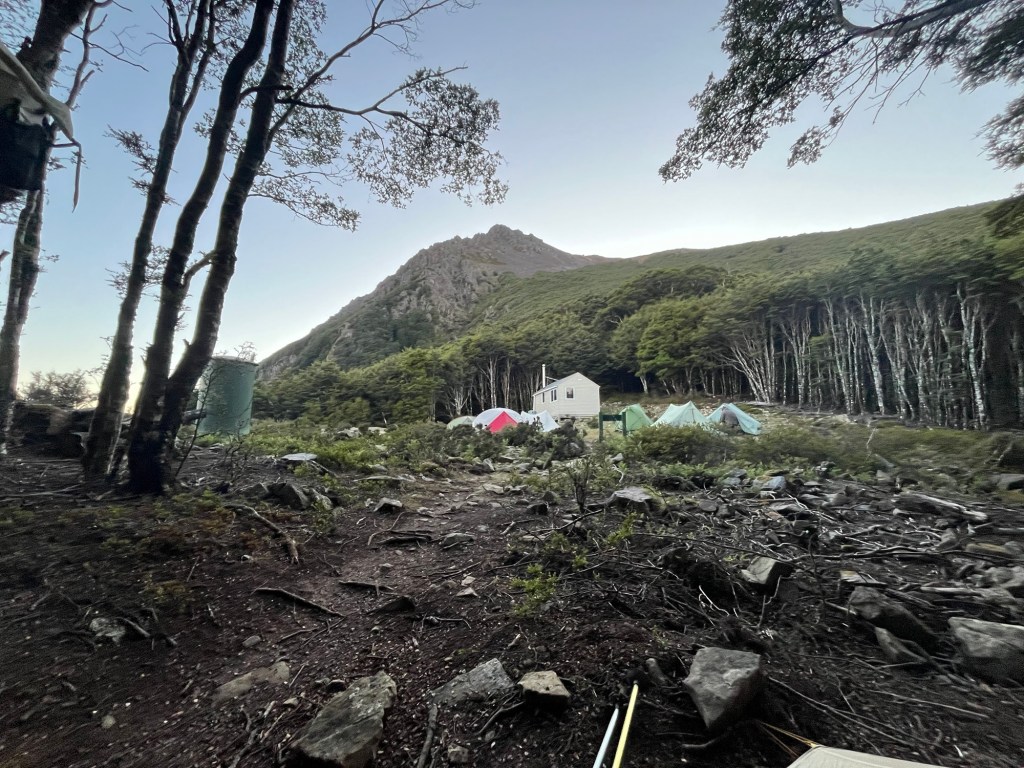
Sheltering by the fire in the wood shed while admiring the bubble’s tent city assembled at Starveall Hut. This was the most tents I’d see in one place on trail.Morning fog from Mt. Starveall
One of these hikers was a young Kiwi named Blake. We met on the road walk from Pelorus Bridge and hit it off pretty quickly. Blake tried to impart the need to maintain equanimity when swarmed by the bloody thirsty midges known as sandflies. Regardless of my meditation practice, he couldn’t have met a less receptive student. At the base of Mt. Rintoul, the centerpiece alpine scramble of the Richmond Alpine track, we joined forces with a lovely Dutch gal, Chris. The three of us spent the remaining four days of the Richmonds together.
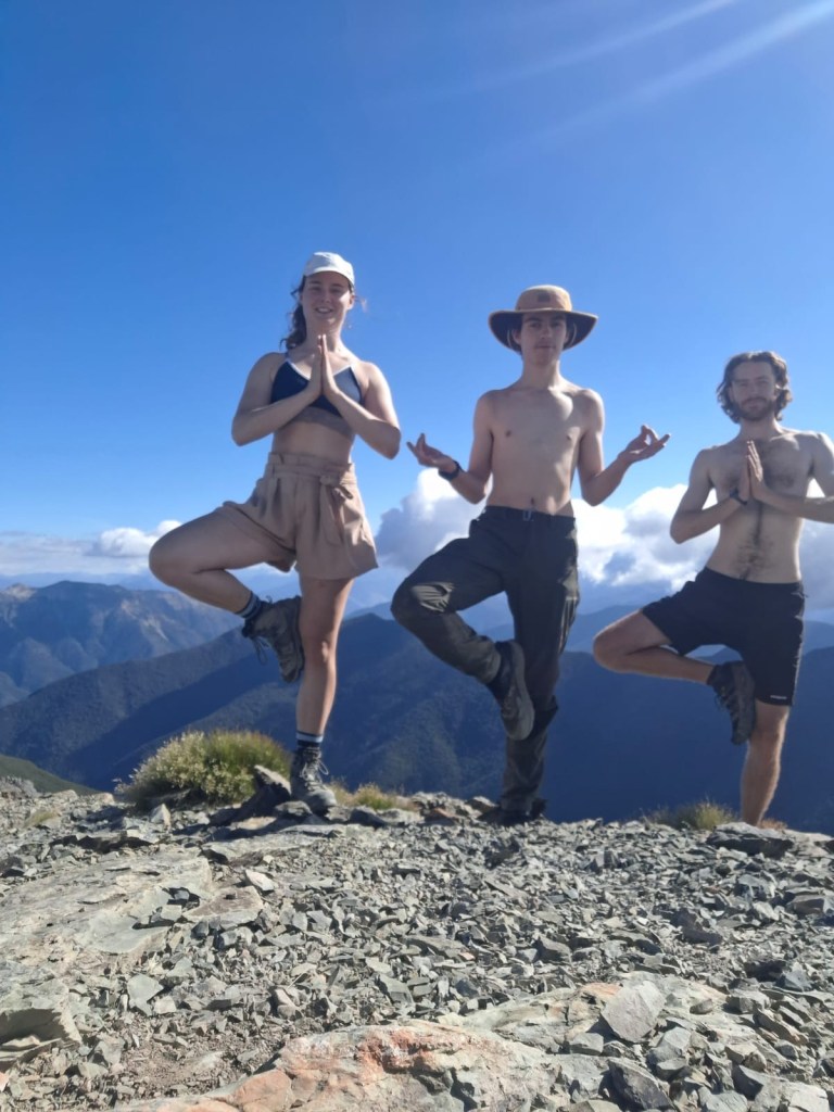
Seeking balance in the Richmonds on Mt. Rintoul
This is a good time to digress on the topic of trails here in NZ. The popular tracks like Abel Tasman, the Routeburn, the Kepler, are well maintained, proper trails that have been built to survive annual runoff and be safely travelled by the masses. This is not the case for the vast majority of NZ’s trails, and certainly not for the TA. Most of the TA is sort of an afterthought of rarely used tracks that have been connected to link north and south. In fact, I’m not sure if there’s ever been any trail building at all along most of the route, or if it’s just the most well trodden foot paths of the old deer hunters and trampers. Kiwis don’t see the value in switchbacks, they’d rather just get it over with and go straight up or straight down the thing. And river tracks, they’re a whole other beast that I don’t have the creativity to describe in words so let me share some photos-
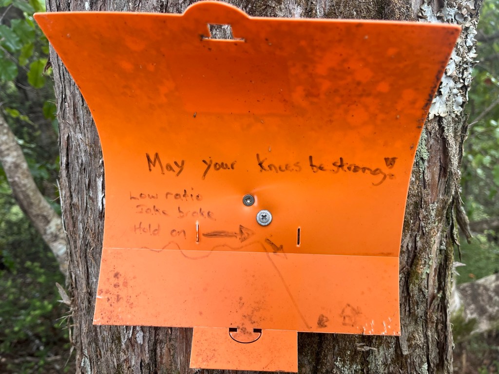
Typical climb through the beech forest. Can’t you see the track?Just push on over. Switchbacks are for lazy Americans!“May your knees be strong! Low ratio, Jake brake, hold on”
The Richmonds were tough, but a challenge in good company makes for good times and better memories.
Camped at the base of Mt. Rintoul with the Rintoul Hut in the mid groundLovely “wild” camp spots below Mt. Ellis
The next stop was St. Arnaud. The bubble cruised out of the Richmond section, descending in a hungry frenzy upon the General Store and Alpine Lodge for a feed and rest. Copious amounts of chips, ice cream bars, meat pies, burgers, hot chips, flat whites, coke, and pizza soothed the hiker hunger we’d all developed of the preceding week.